Review Guidelines for Proposed Projects
This section provides an introduction to the various tools available for proposed projects and orients a project applicant to the review process and requirements.
Projects that disturb one or more acres require the District’s review. Please contact John Loomis (651) 714-3714 or john.loomis@woodburymn.gov.
SWWD_Standards Guidance Manual_Final_11062023
The Standards Guidance Manual (Manual) – is intended to promote consistency, efficiency, and understanding in regard to meeting SWWD stormwater management performance standards applicable to development and redevelopment projects within the watershed. This Manual is written for a variety of audiences including land developers and their engineers, city staff, and other technical professionals working within the watershed.
The Manual is a supplement to the SWWD Watershed Management Plan (2016, as amended) and SWWD Rules (2022, as amended). Through its Watershed Management Plan and Rules, the SWWD has established and periodically updates stormwater management performance standards to protect the public health, welfare, and natural resources of the District. Municipalities within the District are required to adopt controls to enforce those standards. Proposers of development and redevelopment projects that trigger SWWD Rules must demonstrate compliance with these performance standards through the design, analysis, and documentation of best management practices (BMPs).
To most effectively use this Manual, individuals should identify their primary issue and then find the chapter relevant to that issue. This Manual is intended to provide a series of chapters dedicated to particular topics.
SWWD Rules
Under the Minnesota Watershed Law, MN State Statute 103D, the South Washington Watershed District (SWWD) exercises a series of powers to accomplish its statutory purpose. These Rules are adopted to implement those purposes for which the SWWD was formed. Purposes include carrying out the policies contained in the Watershed Management Plan (“the Plan”), coordinating SWWD activities with other governmental agencies, ensuring that water and natural resources are considered, protected, and preserved within the District, ensuring that future regional water management needs are considered in the development of individual subdivisions, developments, and local water management plans (LWMP), and to protect the public health, safety, and welfare.
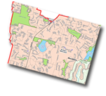
Navigate the South Washington Watershed District Interactive Map.
Technical Data
Once a project applicant is familiar with the review process and requirements, this section provides access to technical data used in the project review process.
GIS Data
Resources, and the required stormwater control requirements, vary across the watershed. Standards included in the SWWD WMP rely strongly on the use of maps to reflect the varying nature of resources across the watershed. It is intended that project proponents will evaluate the different resources affected by their proposed project, and understand the requirements associated with each resource at that location. All requirements must be met but the project proponent is responsible to determine and design for which requirement is most limiting to their site design. The variability across the watershed means that the volume control requirement may be most limiting at one site while the nutrient load requirement may be most limiting at another site. Access to relevant GIS shapefiles, GRIDs and metadata are provided below.
Map 6.1 Wetlands and designated classifications (Metadata | ESRI Shapefile)
Map 6.3 Regional assessment locations (Metadata | Map6-3_shapefile)
For more information, please review Sections 1.2 and 2.2 of the Standards Manual, for discussion of the SWWD stormwater standards and available GIS data.